Introduction
The Invisible Inside the Visible was a personal quest turned art project to locate physical evidence of a century-old racetrack on the Cape John peninsula in the village of River John, Nova Scotia.
The journey to find the racetrack was marked by its double invisibility. Not only was it remembered without specificity in regard to location, it was also invisible to the observing eye because it was embedded into the landscape.
I see the performative gesture as a physical articulation akin to a vibration; it disrupts the stability of the narrative. This project adds to the discourse investigating maps, memory, rural community, oral history, depictions of landscape, performance as tool, and the potential for dialectical articulations of place and history. This exposition is a reflection on the nature of landscape as a marker of cultural geography, and on my ability as an artist to pull the past forward through performance.
The Invisible Inside the Visible
[scroll left to right]
Click for larger image
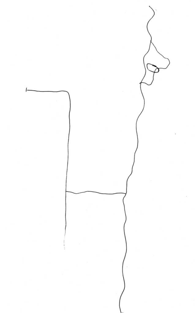
Interview: Willis Langille
Click for larger image
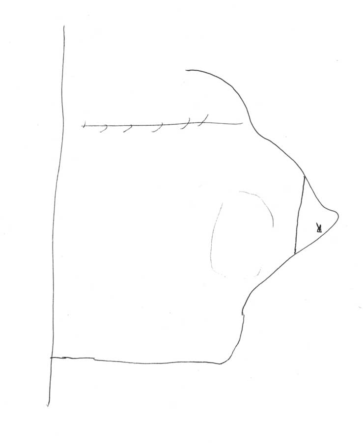
Interview: Donnie Langille
Click for larger image
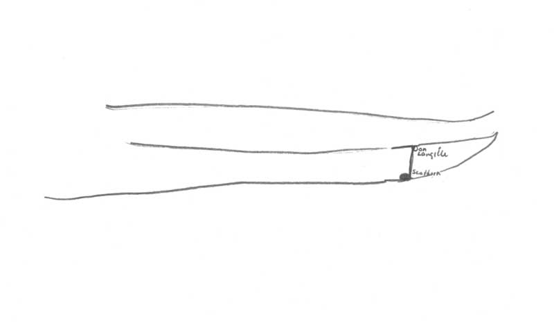
Interview: Margaret MacLean
Click for larger image
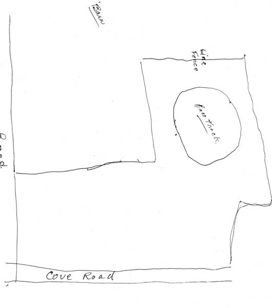
Interview: Mildred Heighton
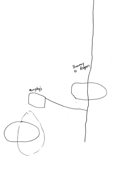
Click for larger image
Interview: Jim Baillie Sr
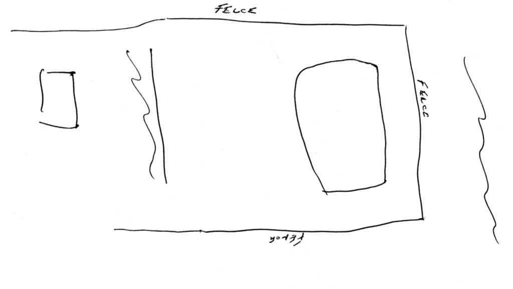
Click for larger image
Interview: Ross MacKay
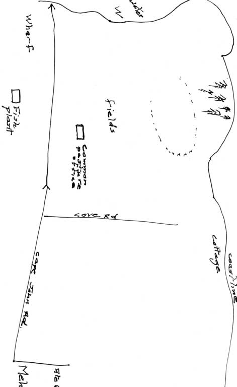
Click for larger image
Interview: Susan Sellers
I am of a place. I return there, sometimes. I am the revenant,1 returning to the place of my birth. The place is Caribou River, Nova Scotia.2 The place is itself. The reading of personal and cultural markers into a place defines it as a landscape. Initially, I am hesitant to use the word landscape for fear it anchors one too specifically, or becomes quaint. Yet, I am curious about how specificity of place can be examined and made unstable through an artistic practice. For the purposes of this paper, I will use the word landscape in relationship to invisibility and the possibility of creating landscape through touch or language. My hypothesis, based on my own experience while making this work, is that a landscape can exist as an invisible and limitless fold between language and touch.
In 2012, I was asked to be part of the W(here) project3 (curated by Mary MacDonald), the goal of which was to look at the potential of contemporary art in rural communities. Both Mary and I had grown up in Pictou County, she in the town and I in the country. When Mary approached me, I had recently purchased a small cottage in River John, where I live seasonally. The village of River John is a few minutes from Caribou River, where I grew up.
I was particularly interested in Meh’s gas station in River John, which functions as a meeting place for the community, general store, and hub of social interaction. Although I didn’t know what my final work would be, I proposed using the gas station as a point of dissemination for the commissioned work.4
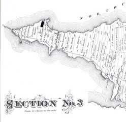
For two summers I had been on an unsuccessful quest to find River John’s historic racetrack. The track, called Seaview Trotting Park, had functioned in the 1920s, located on the outer tip of the Cape John peninsula.5 Local legend said it could still be seen in the land. The idea of a quest for a semi-forgotten landscape was alluring. The commission became an opportunity to document the process of finding the mark of the track by asking for directions from the community.
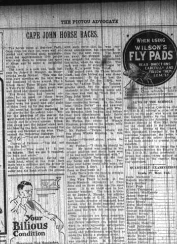
When in operation as a racetrack, the land was owned by James Murphy. In the early 1960s it was part of a larger area purchased by the Nova Scotia government for community pasture land. Since then, more than seven hundred acres of land (of which the racetrack is part) have been reserved for grazing cows in the summer. At the time the racetrack was built, harness racing was a popular form of entertainment for rural communities (similar tracks existed nearby in Thorburn, Tatamagouche, and Truro). There were frequently crowds of over a thousand at Cape John’s Seaview Trotting Park.6
It was a time of relative prosperity in the River John community. There were ten canneries, restaurants, stores, and a sense of growth engendered by the boat building industry, which continued to prosper until the 1920s when new economic realities forced the industry into decline. Fishing, another primary resource, saw hard times as well, and although stabilised had to significantly contract in the 1980s and 1990s. By 2012 the ten canneries had shrunk to none. What followed from the loss of industry was a slow descent from a thriving community to one that, in 2013, has few young people and no viable industry with which to attract or keep a younger population. Currently, seventy per cent of the population is over forty (Nova Scotia Community Counts 2011). The popularity of the gas station as a central gathering place is in part because it is one of very few businesses still in existence and has expanded its offerings to include food, coffee and breakfast, hardware supplies, garden plants, wood, and propane. This should not be painted as a unique or tragic tale. This is the story of many rural communities in Nova Scotia.7
The initial components of the project:
The racetrack.
The people interviewed: twelve in total, with seven interviews being used as documentation online and in the newspaper. All the participants had some knowledge of the racetrack; all were over the age of forty. One participant, James Baillie, actually witnessed the last race at the track.
The method: engage with a community through interviews, gathering directions and maps to find a hidden mark in the land.
The results were surprising. In all the interviews and drawn maps, there emerged the reality of a landmark not actually seen. Although the racetrack figured prominently as a cultural marker (and, I would suggest, was emblematic of ‘better days’), its physical location was largely unknown.8 Two reasons for this became immediately clear: first, the site occupies a difficult9 location at the tip of the Cape John peninsula; second, the mark of the racetrack is embedded into the land. This is not a landscape visible with our normal gaze out and over a space. We do not see it rise from the horizon. In this case, the object of our intention resists verticality of vision and instead is marked into the land.
How can we know a landscape that is unseen? I propose that we know a landscape by having lived inside of it.10 Donald Meinig (1979, 34) states, ‘Thus we confront the central problem: any landscape is composed not only of what lies before our eyes but what lies within our heads.’ The manifestation of this cultural knowledge can be either physical or, in the case of the Cape John Racetrack, invisible to the eyes but made visible through language.
Thus, the title for the project became The Invisible Inside the Visible.11
A shared cultural landscape, although invisible to the eye.
Invisible to the gaze because embedded into the earth.
The racetrack exists as an ordering system, a way of both providing and holding onto a framework for the passage of time and importance. James Duncan (1990, 17) argues that ‘The landscape […] is one of the central elements in a cultural system, for as an ordered assemblage of objects, a text, it acts as a signifying system through which a social system is communicated, reproduced, experienced, and explored.’ In this context, the racetrack landscape functions through time yet retains currency as a pointer for current activities. Many of those interviewed referenced the racetrack as a pointer for current activities – ‘It was near the racetrack that you [swam, picked strawberries, etc.]’ – making it also an important marker of a different cultural and economic time. Although it continues to change its designation as a signifier, what it signified in terms of a cultural and economic time period remained constant. It marks the past while referencing present activities.
Barbara Bender (2002, 103) describes landscapes as ‘always in process of being shaped and reshaped. Being of the moment and in process, they are always temporal. They are not a record but a recording, and this recording is much more than a reflection of human agency and action; it is creative of them.’ Bender’s work suggests the creative movement of the landscape. This is true of the Cape John racetrack, where the societal memory of ‘better days’ was carried forward as the racetrack gained mythological and imaginary presence. It became a fluid marker in the history of the community, articulating a relationship to time and place.
This idea of a landmark inscribed into the consciousness without needing to be present speaks physically to the power of and need for lines of historical and temporal grounding. Duncan argues that ‘By becoming part of the everyday, the taken-for-granted, the objective, and the natural, the landscape masks the artificial and ideological nature of its form and content. Its history as a social construction is unexamined. It is, therefore, as unwittingly read as it is unwittingly written’ (1990, 19, quoted in Cresswell 2003, 272–73).
The reference to text (language) is important. In this case, the creation of a mythology through language allows for a continuation of form. I am interested in the idea of the corporeal (body) as perceiving subject and also that which generates form through language.12 I am looking at various ways to consider the multiplicity of story – language and touch are two ways of enfolding13 multiple histories and unexpected conjunctions.
At this point, I return to the idea of the two kinds of invisibility that are inhabited by the landscape. The first is the absence of physical presence; it is an imagined landscape passed down through language. The invisible landscape maintains a sense of continuity and historical-temporal rootedness to those who live there. The second idea is the invisibility of that which exists in the land without any horizon/vertical demarcations. The next part of the project involved trying to find the physical mark of the racetrack.
The drawn and oral maps, however divergent they were as explanations of location (or lack thereof), gave me further incentive to go out and try again to find the racetrack. I did find it this third time. I was fortunate to have the aid of a community pasture employee, Ross. We went out together after he and his co-worker made certain there were no cows in the pasture. Contrary to our usual way of knowing a place, we were looking down, not up. More than anything, we were feeling with our feet, excavating an imaginary landscape by touch. In this haptic environment, touch trumped all other senses. I didn’t know the right way to decide when we had ‘found it’. We kept asking each other, ‘Is this it?’ ‘Do you think this is it?’ We only realised that we were correct when we ended up walking in an oval. Even at this point, I kept asking whether the grass was a different colour in the oval. I wanted a visual marking of the spot, not just that which was felt. How to trust this haptic experience of a landscape?
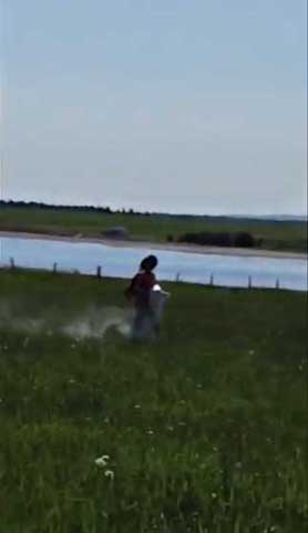
The following day, I moved dehydrated lime (used for marking lines on playing fields) out to the pasture and proceeded to feel my way around the track, shaking the chalk-like substance behind me.14 All the grass that was temporarily displaced by my passage, the white mark as gesture drawing onto the land, these were moments of illumination of a landscape from the past into the present. In an extreme of both close and distant viewing, the mark made through the performative gesture was then photographed from an airplane. This aerial view made visible not just the white line of the performed mark existing as a slightly unfinished oval (due to fence line positioning and growth of trees), but also showed the many cow paths accumulated over the years. These aleatory lines showed the physical mark of time’s passage, providing a reminder of land as material in a constant state of change and rewriting.
The photograph existed as another type of proof, or story, to confound previous ones – that of the track being eroded to varying degrees. However, just as this mark ‘proved’ it also disappeared (with the rainfall that occurred that evening).
The mark of the body touching the land and the language creating the mythology of the structure are two non-visual ways of establishing presence. As suggested earlier, they are both felt through the body before being articulated to the world. A processing occurs, wherein the story of the landscape rises between the articulation through the body and through the land. That which is held between these two felt surfaces is a multiple of embodied narrative.
It is, as Merleau-Ponty (1968, 227–28) states,
A certain relation between the visible and the invisible where the invisible is not only non-visible (what has been or will be seen and is not seen […]), but where its absence counts in the world […] where the lacuna that marks its place is one of the points of passage of the ‘world.’ It is this negative that makes possible the vertical world.
These historical landscapes provide a way of moving outward from, and keeping ordered, our relationship to a culture in a land. I realised that the invisibility of the track, and its treatment as landscape in the cultural imagination, created a myth that included the ‘partial escape from the temporal flux which landscape, treated as scenery, unfailingly represents as an occurrence’ (Smith 1993, 79). Historical passage points, whether real or imaginary, act as portals through which lines of flight are thrown to anchor the present. I saw the project as an opportunity to explore the idea of performance onto the past as a way of allowing for inauthenticity, which ‘allows room for manoeuvre, allows stances, of ownership, identity and interpretation, to be confirmed, challenged, confounded at the same time’ (Pearson and Shanks 2001, 146, quoted in Cresswell 2003, 279).
The final step for the project was to translate it back into the community. I created an eight-page newspaper15 that included a centrefold of the aerial photo of the track, as well as portions of interviews and documentation from the performance of the mark. I wanted to put the photograph of the mark, another story of presence and absence, into the collective narrative of the track. In this case the story was embodied in a white line seen from the sky – a temporary hovering over multiple tenses (past/present) and the idea of revenance.
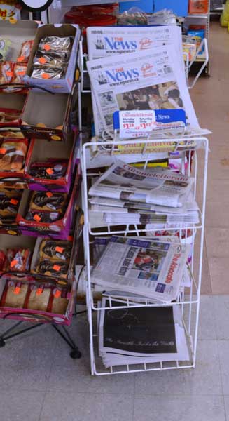
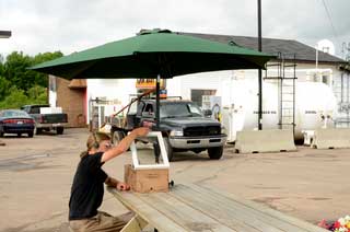
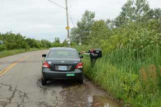
The newspapers were available at Meh’s gas station,16–17 the place I had initially chosen as a dissemination point. They were also hand delivered18 to the residents of the Cape John peninsula, where the racetrack was located. I wanted to create a document that would be authoritative in the allusion to ‘news’ and the inclusion of a photograph, yet also subject to temporal irrelevance and deterioration – of the newspaper itself – over time.19
In conclusion, I contemplated the racetrack landscape, as it exists, without recognisable visual clues, as being a unique tie to history and place. If the track were unreal as a visible physical mark, the most real would always be the most recent iteration in time. For instance, one evening as I was replenishing newspapers, a resident started telling me a story about the track. I was keenly aware that each telling was as authoritative as the one that came before it. It is a sort of temporal equivalency. Language charts authority over place.20 The importance of the track as a supposed anchor in time, from which stories occur to establish relationship to the present, was apparent. The worn cow tracks that diverge from and through the racetrack (as seen from the aerial photo) chart their authority of physical mark. In both cases, the lines and passage of time create alternative stories, alternative marks over and through the original landscape.
Place, ultimately, is carried as a deeply felt map in the body. I propose it is carried through language, which is a way of remembering through the body of a place. The stories transform the racetrack from a physical location in place to a physical location in language. This is clarified by Merleau-Ponty in his unfinished work The Visible and the Invisible: ‘It is as though the visibility that animates the sensible world were to emigrate, not outside of every body, but into another less heavy, more transparent body, as though it were to change flesh, abandoning the flesh of the body for that of language’ (1968, 153). I propose that language as a felt mark is folded into the body as one-half of a fold; the other half is the land itself, which holds the physical mark of the event. Together they provide ‘an interior horizon and an exterior horizon between which the actual visible is a provisional partitioning and which, nonetheless, opens indefinitely only upon other visibles’ (Merleau-Ponty 1968, 152).
For a moment it was a mark on the land, visible from the sky. It rained. The mark is gone. The last story told is once again the most true.
Language creates its own geography a thousand different times.
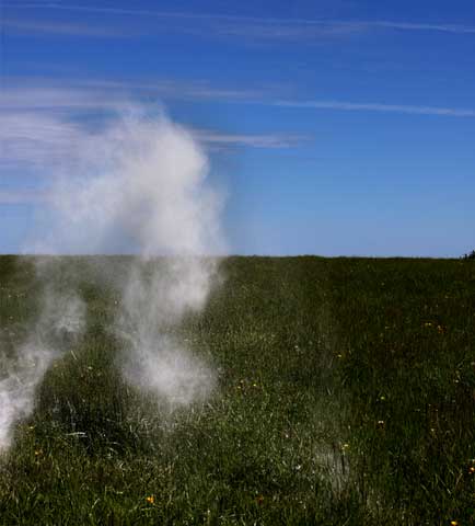
View of the chalk dispersing as it is laid down to make the mark, 2012.
Click here to watch performance of laying the mark into the landscape.
Notes
1Revenant n. 1. One who returns from the dead; a ghost. 2. One who returns to a place (Oxford English Dictionary 2013).
Return to Reference.
2Maps mark the edges of things. I feel as if I could spend my whole life running my hand over the edge of Nova Scotia, trying to understand how I can truly be a part of this place, or why I will never truly be a part of this place. By truly I mean that one does not think about it, it is. By this definition, I suppose, I will never truly be of the place.
Return to Reference.
3See the 2012 W(here) Festival flier.
Return to Reference.
4My artistic practice often explores the potential for unmooring history from place, of putting down new lines and proposals for how place and story could fit together (for example, a road sign stating ‘Jesus was born in Nova Scotia’, a fan club for a local giantess of the nineteenth century, twenty-six sewn views of Nova Scotia, etc.). The potential for putting various degrees of pressure on historical or cultural truth points, with the possibility of the new emerging from such attention and reconfiguration, is what has interested me and pushed me to make work.
Return to Reference.
5Map of Cape John peninsula, with projection of where the track was located, 1900.
Return to Reference.
6Pictou Advocate newspaper, Friday, 8 July 1921.
Return to Reference.
7There are some exceptions, including the village of Tatamagouche, ten kilometres down the road, which has seen an influx of people who have chosen to live there and try to create alternative communities. The socio-economics are immediately apparent: many of those moving to the rural community have greater mobility and vision for what they want the area to become. Some friction between that which has been and the new might manifest as class distinctions and differences of opinion over improvements.
Return to Reference.
8For instance, everyone knows of it, but no one knows where it is. Thus the refrain in many of the interviews in relation to its location, ‘So I’ve been told/So I’ve heard’.
Return to Reference.
9Although not inaccessible by any means, neither is it easy to access. One has to climb over fences and be on community pasture to find it.
Return to Reference.
10The way we learn it as a child is by holding onto it, and pulling ourselves around the form of it. So it is that I am still looking for the form of the place I am from. I return often, to try to understand it, to explore, to feel it, and to try to remember who I was then, who I am now, and how we can know a place in two different times.
Return to Reference.
11Later I discovered The Visible and the Invisible by Maurice Merleau-Ponty, an unfinished treatise continuing his exploration into phenomenology of experience and perception as linked and ever changing.
Return to Reference.
12It is useful to consider the response of Gilles Deleuze to Michel Foucault, in which he emphasises ‘the gap between nondiscursive and discursive practices – that is, the gap between the realm of the perceivable or the sensible and the realm of the articulable, which is the realm of statements’ (Lorraine 1999, 200).
Return to Reference.
13Consider the idea of enfolding, and the importance of touch and embodied language as articulated by Luce Irigaray (Lorraine 1999, 12).
Return to Reference.
14Click performance of laying the mark into the landscape, 2012.
Return to Reference.
15Newspaper, pdf.
Return to Reference.
16Installation of the newspaper at Meh’s gas station, River John.
Return to Reference.
17Installation of newspaper and audio outside Meh’s gas station.
Return to Reference.
18Delivery of newspapers to residents of Cape John.
Return to Reference.
19‘[…] not to restore what has been abolished (by time, by distance) but to attest that what I see has indeed existed’ (Barthes [1981] 2010, 82).
Return to Reference.
20‘Landscape may be seen […] as a “dialectical image”, an ambiguous synthesis whose redemptive and manipulative aspects cannot finally be disentangled, which can neither be completely reified as an authentic object in the world nor thoroughly dissolved as an ideological mirage’ (Daniels 1989, 206).
Return to Reference.
References
Barthes, Roland. (1981) 2010. Camera Lucida. Translated by Richard Howard. New York: Hill and Wang.
Bender, Barbara. 2002. ‘Time and Landscape’. Current Anthropology 43 (S4): S103–S112.
Cresswell, Tim. 2003. ‘Landscape and the Obliteration of Practice’. In Handbook of Cultural Geography, edited by Kay Anderson, Mona Domosh, Steve Pile, and Nigel Thrift, 269–282. London: Sage.
Daniels, Stephen. 1989. ‘Marxism, Culture and the Duplicity of Landscape’. In New Models in Geography: The Political-Economy Perspective, edited by Richard Peet and Nigel Thrift, 2 vols., 2:196–220. London: Unwin Hyman.
Duncan, James S. 1990. The City as Text: The Politics of Landscape Interpretation in the Kandyan Kingdom. Cambridge: Cambridge University Press.
Lorraine, Tamsin. 1999. Irigaray and Deleuze: Experiments in Visceral Philosophy. Ithaca, NY: Cornell University Press.
Meinig, D. W. 1979. ‘The Beholding Eye’. In The Interpretation of Ordinary Landscapes: Geographical Essays, edited by D. W. Meinig, 32–48. New York: Oxford University Press.
Merleau-Ponty, Maurice. 1968. The Visible and the Invisible. Edited by Claude Lefort. Translated by Alphonso Lingis. Evanston: Northwestern University Press.
Nova Scotia Community Counts. 2011. ‘Nova Scotia Community Counts: Geography: River John, Year: 2011.’ Nova Scotia. Accessed 22 December 2013.
Oxford English Dictionary. 2013. ‘Revenant, n.’ In Oxford English Dictionary, online version. Accessed 8 July 2013.
Pearson, Mike, and Michael Shanks. 2001. Theatre/Archaeology. London: Routledge.
Smith, Jonathan. 1993. ‘The Lie that Blinds: Destabilizing the Text of Landscape’. In Place/Culture/Representation, edited by James Duncan and David Ley, 78–92. New York: Routledge.
Further reading
Anderson, Kay, Mona Domosh, Steve Pile and Nigel Thrift, eds. 2003. Handbook of Cultural Geography. London: Sage.
Cosgrove, Denis and Stephen Daniels. 1988. The Iconography of Landscape. New York: Cambridge University Press.
Duncan, James, and David Ley, eds. 1993. Place/Culture/Representation. New York: Routledge.
Schama, Simon. 1995. Landscape and Memory. New York: Random House.